Countries
Bhutan
- Wikitravel :: http://wikitravel.org/en/Bhutan
- Tourism Council of Bhutan :: http://www.tourism.gov.bt/
Burma / Myanmar
- Wikitravel :: http://wikitravel.org/en/Myanmar
- Myanmar Ministry of Hotels & Tourism :: http://www.myanmartourism.org/
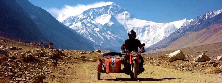
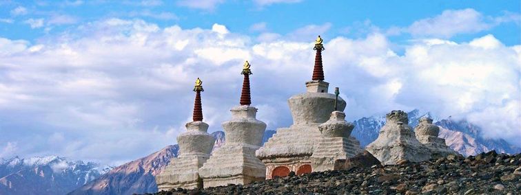
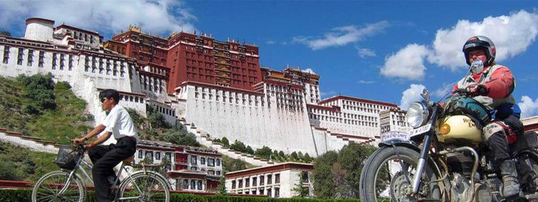
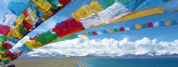
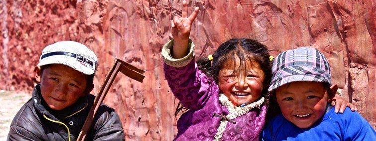
China & Autonomous Region Tibet
- Wikitravel :: http://wikitravel.org/en/China
- National Tourism Office China :: http://www.cnto.org/
- Wikitravel :: http://wikitravel.org/en/Tibet
- National Tourism Office China / Autonomous Region Tibet :: http://www.cnto.org/
| Area | 9.6 mio km² (Europe without Russia, Turkey - 4,9 Mio. km²) [Tibet: 1.2 mio km² (about the size of Germany + France + Italy)] |
| Population | about 1.3 Billion [Tibet: 2.4 mio] |
| Population Density | 130 cap. per km² |
| Capital | Beijing (Peking). Population: about 13 mio |
| Geography | China has a varied terrain ranging from high plateaus in the west to flatlands in the east; mountains take up almost one-third of the land. The most notable high mountain ranges are the Himalayas, the Altai Mountains, the Tien Shan Mountains and the Kunlun Mountains. On the border with Nepal is the 8.848 m-high (29.198 ft) Mount Everest. In the west is the Qinghai/Tibet Plateau, with an average elevation of 4.000 m / 13.200 ft), known as the "Roof of the World". China has many great river systems, notably the Yellow (Huang He) and Yangtze Kiang (Chang Jiang). Only 10% of all China is suitable for agriculture. |
| Government | People's Republic. China comprises 23 Provinces, 5 Autonomous Regions, 2 Special Administrative Regions and 3 Municipalities under Central Government. |
| Language | The official language is Mandarin Chinese. Large groups speak Cantonese. Mongolia, Tibet and Xinjiang, which are autonomous regions, have their own languages. English is spoken by many guides. |
| Religion | The principal religions and philosophies are Buddhism, Daoism and Confucianism. There are 100 million Buddhists and approximately 60 million Muslims, five million Protestants (including large numbers of Evangelicals) and four million Roman Catholics, largely independent of Vatican control. [Tibet: Buddhism, with Bön (schaman) influences] |
| GNP | 1.0 Trillion USD, annual income per head: 860 USD (Germany about 23.000 USD) |
| Timezone | GMT/UTC + 8 hrs |
| Electricity | 200/220 V, 50 Hz. Two-pin sockets and some three-pin sockets are in use. |
| Phone | IDD is available. It is often easier to make international phone calls from China than it is to make domestic calls. |
| Mobile Phone | GSM 1800 and 900 networks provide coverage in Beijing, Guangzhou (Canton) and Shanghai. GSM 900 networks also exist in most other major urban areas. |
| Internet/E-Mail | There are cybercafés in main towns. |
| Service to Europe takes from between two days and a week. Tourist hotels usually have their own post offices. |
India
- Wikitravel :: http://wikitravel.org/en/Indien
- Governement of India - Tourist-Office :: http://www.incredibleindia.org/
- Official Website of Rajasthan Tourism :: https://www.tourism.rajasthan.gov.in/
- Official Website of Sikkim Tourism :: http://www.sikkimtourism.gov.in/
| Area | 3.287.000 km² (1.269.000 mi²) |
| Population | 1.014.003.817 (2000) |
| Population Density | 310 cap. per km² |
| Capital | New Delhi. Population approx. 10 mil |
| Geography | India shares borders with Pakistan, China, Nepal and Bhutan as well as Bangladesh and Myanmar. To the west lies the Arabian Sea, to the east the Bay of Bengal and to the south the Indian Ocean. The country can be divided into three regions: the Himalayan mountain range, which forms with its length of 3500 km India's northern- and eastern border. The Ganges River, who crosses the entire north and to the south the Dekhan plateau with the Western Ghats and the Eastern Ghats. |
| Government | Republic since 1947 |
| Language | About 30% of the population speak the national language, Hindi. Besides that there are 17 regional languages recognised by the governement. English is also often used for official or commercial purposes. |
| Religion | 80% Hindus, 11% Muslems (8% Sunnites, 3% Shiites), 2,5% Christians, 2% Sikhs, 1% Buddhists and others. |
| GNP | USD 1.7 Billion, annual income per head: USD 1.720 (A, D around 23.000 USD) |
| Timezone | GMT/UTC + 5,5 hrs |
| Electricity | 220 Volts, 50 Hz; There are frequent power cuts. |
| Phone | STD/IDD shops can be found all over the country. |
| Mobile Phone | GSM 900. Coverage is limited to major towns. |
| Internet/E-Mail | Cybercafés can be found all over the country. |
| Airmail to Europe takes about a week. Make sure that letters are hand-cancelled at the post office. |
Kyrgyzstan
- Wikitravel :: http://wikitravel.org/en/Kyrgyzstan
- State Agency of Tourism :: http://www.kyrgyzjer.com/en/Tourism/section47/
Nepal
- Wikitravel :: http://wikitravel.org/en/Nepal
- Tourist-Board of Nepal :: http://welcomenepal.com/
| Area | approx. 150.000 km² |
| Population | 22.000.000 (1998) |
| Population Density | 155 cap. per km² |
| Capital | Kathmandu. Population: 600.000 |
| Geography | Nepal is a landlocked kingdom sharing borders with Tibet and India. The greater part of the country lies on the southern slope of the Himalayas, extending down from the highest peaks through hill country to the upper edge of the Ganges Plain. The hilly central area is crossed by the Lower Himalayas, where there are eight of the highest peaks in the world, leading up to Mount Everest. |
| Government | Constitutional monarchy. Head of State: King Birendra Bir Bikram Sháh Dev since 1972, Head of Government: Prime Minister Girija Prasad Koirala since 2000. |
| Language | The official language is Nepali. There are many other languages and dialects. English is spoken in business circles and in the field of tourism. |
| Religion | 90% Hindus plus Muslims, Christians and Buddhist. Animistic traditions remain until today. |
| GNP | 26.2 Bn USD, annual income per head: 1.100 USD (A, D about 23.000 USD) |
| Timezone | GMT/UTC + 4,45 hrs |
| Electricity | 220 Volts, 50 Hz; There are frequent power cuts. |
| Phone | IDD is available in all major cities. Hotels and private communication centres provide long-distance telephone services (ISD, STD) |
| Mobile Phone | The Nepalese mobile network uses a frequency, which is not compatible with GSM or other mobile services. |
| Internet/E-Mail | There are cybercafés in Kathmandu and Pokhara. |
| Postal services are available in most centres. Make sure that letters are hand-cancelled at the post office. |
Thailand
- Wikitravel :: http://wikitravel.org/en/Thailand
- Tourism Authority of Thailand :: http://www.tourismthailand.org/
Vietnam
- Wikitravel :: http://wikitravel.org/en/Vietnam
- Vietnam Tourist Board :: http://www.vietnamtourism.com/